Experience
National Remote Sensing Centre (ISRO)
Scientist/Engineer - "SE"
July 2016 - PresentNRSC (ISRO)
Scientist/Engineer - "SE"
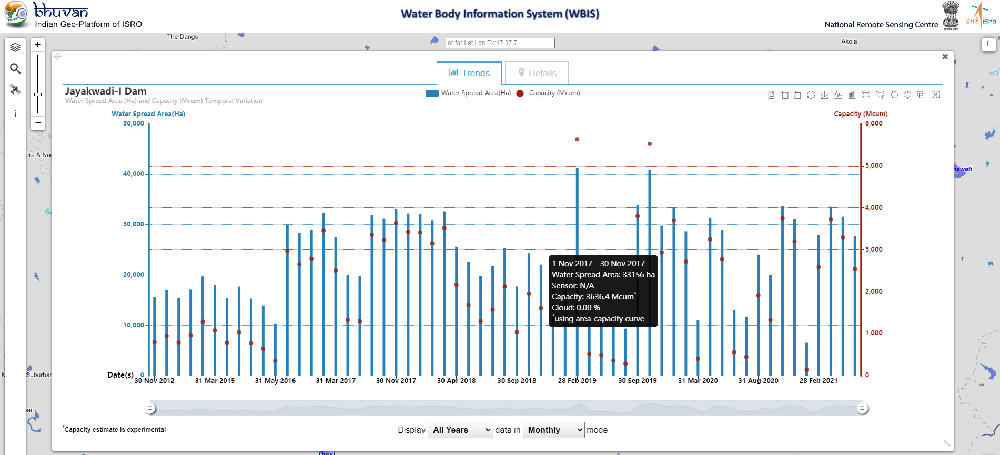
July 2016 - Present- Built reliable drought monitoring models used by government agencies.
- Designed ETL pipelines with open-source tools & automated satellite data processing.
- Developed ML models integrating satellite and field data.
- Streamlined data workflows and leveraged multi-source geospatial data for insights.
Regional Remote Sensing Centre
Project Trainee
Jan 2016 - May 2016RRSC
Project Trainee
2016Worked towards the application of object-based classification techniques for the identification of citrus orchards using Remote Sensing and GIS tools.